
Land Survey for Fence Projects That Cross Old Seawall Property Lines
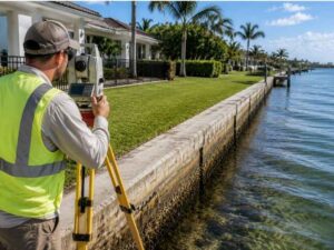
Building a fence near an old seawall isn’t as simple as it looks. The seawall might seem like a clear line between your yard and the water. But that line can fool you. A land survey for fence work in a spot like this shows what’s really true about the property. It shows more than what the seawall suggests. This step matters most before any posts go in the ground.
Why Seawall Locations Can Create Challenges During Fence Planning
Many people think a seawall marks the exact edge of their property. That guess isn’t always right. Seawalls were built based on the shoreline conditions at the time. Years later, those conditions can shift. The legal line stays right where it was drawn on paper.
This gap between the seawall and the true property line can cause real mix-ups during fence planning. A homeowner might plan a fence right along the seawall. Then they find out later that the real line sits somewhere else. Past changes to the property add more doubt. A past owner might have moved the seawall, added fill dirt, or made other changes that never got written down.
None of this means a fence project near a seawall can’t work. It just means the planning stage needs a clear picture of what’s true today, not just what the shoreline looks like.
Reviewing Waterfront Records Before Installing a Fence Along an Old Seawall
Before any fence goes up near a seawall, it helps to look back at the records tied to the property. Old surveys, deeds, and past papers can show how the line was first set. They can also show if anything has changed since then.
This kind of check matters more for waterfront fence projects than for a plain backyard fence. Waterfront spots shift over time in ways inland lots usually don’t. A record from decades ago might describe a shoreline that no longer matches what’s there today.
Checking these records early gives homeowners a much clearer starting point. It also helps stop a fence from getting built on a stale guess about where the seawall and the property line actually meet.
How Survey Data Helps Determine Fence Placement Near Seawall Structures
Once the records get checked, survey data fills in the rest of the picture. Field measurements show exactly where the property line sits compared to the seawall and other waterfront features.
This information helps homeowners see what space is actually usable. A fence planned too close to the water might end up crossing the real line, even if it looks fine next to the seawall. Survey data catches this kind of mismatch before work starts, not after.
Knowing the usable part of the property also helps with design choices. A fence layout that respects the real boundary avoids fights later and keeps the project matched to what the property actually allows.
Identifying Site Conditions That Affect Fence Layout Along Coastal Properties
Coastal properties come with things inland lots simply don’t have. An uneven shoreline can curve or shift in ways that make a straight fence line hard to plan without careful measuring. Seawall alignment adds another wrinkle, since the wall might angle differently than the actual property line.
Access spots near the water also need attention. A fence that blocks a path used for boat access or dock upkeep can cause problems down the road, even if the fence itself sits on solid ground. Existing improvements near the water, like stairs or small platforms, can make it harder to find where a fence reasonably fits.
Checking these conditions early helps homeowners avoid a design that looks fine on paper but runs into trouble once it meets the real shoreline.
Coordinating Fence Design Decisions With Verified Waterfront Property Information
Once the site conditions and boundary facts get confirmed, it becomes much easier for everyone involved to make good calls. Homeowners, fence contractors, and designers all gain from working with the same checked facts rather than guessing based on how the seawall looks.
This kind of teamwork cuts down on surprises once work starts. A contractor working from confirmed measurements can plan the fence layout with confidence. There’s no need to adjust mid project because the seawall didn’t match the real property line.
Fewer surprises mean a smoother project overall. When everyone starts with the same true picture of the waterfront property, the fence design process moves forward with far less guesswork.
Frequently Asked Questions
Why should a survey be completed before installing a fence near an old seawall?
A survey can help identify the relationship between the proposed fence location, property features, and existing seawall conditions before installation begins.
Can an old seawall show the actual property boundary?
Not always. A seawall may have been built based on older conditions and may not accurately represent the current legal property line.
What makes waterfront fence projects different from typical fence installations?
Waterfront fence projects may involve additional site considerations, including seawall locations, shoreline features, and existing improvements near the water.
Who uses survey information for a fence project near a seawall?
Property owners, fence contractors, designers, and other project professionals may use survey information when planning fence placement.
When should a land survey be completed for a seawall-related fence project?
Survey information is most useful before fence plans are finalized or construction begins so decisions are based on current site conditions.
For a free land surveying quote, call us at (954) 250-5780 or send us a message by going here.
Posted in land surveying | Tagged land surveying