Why Older Waterfront Homes May Need Updated Elevation Certificate
An elevation certificate from 10 years ago looks perfectly fine. It has a surveyor’s stamp. It has official signatures. But it may be costing you money right now, and you might not even know it.
FEMA updates its flood maps. Sea levels shift. Base flood elevations get recalculated. A certificate that was accurate in 2010 may tell a very different story from what FEMA measures today.
For developers buying or renovating older waterfront homes, this gap can mean higher insurance costs, permit delays and loan complications. Getting this right before closing is not optional. It’s part of doing the job correctly.
Flood Maps Don’t Stay the Same Forever
FEMA’s Flood Insurance Rate Maps (FIRMs) get updated regularly. When a new map takes effect, it can change a property’s flood zone and its Base Flood Elevation (BFE).
The BFE is the number that everything else is based on. It tells you the elevation a building needs to reach to have a reasonable chance of staying dry during a 1-in-100-year flood event.
If FEMA raises that number after a map update, an older certificate may show an elevation that no longer meets the current standard. That directly affects insurance pricing, permit approvals and what lenders will require.
What a Map Change Means for an Older Property
A property built in the 1980s may have been constructed to meet the flood standards of that time. Those standards have changed. A new FIRM may place the same property in a higher-risk zone or assign it a higher BFE than before.
An elevation certificate that predates the new map won’t reflect any of that.
Sea Level Rise Is a Real Factor in South Florida
South Florida has seen measurable sea level rise over the past few decades. NOAA data shows the region has experienced roughly 4 to 8 inches of rise since the early 1990s.
That may not sound like much. But for a waterfront home already sitting close to its BFE, a few inches can shift the whole insurance equation.
Ground subsidence adds to the problem. Soil in some coastal areas compresses over time. A home that was elevated well above flood level when it was built may have literally settled closer to that line since then.
An old elevation certificate cannot account for either of these changes.
FEMA’s Risk Rating 2.0 Changed How Flood Insurance Gets Priced
In October 2021, FEMA rolled out a new flood insurance pricing system called Risk Rating 2.0. It replaced a decades-old model that had significant gaps.
Under the old system, two neighboring homes could pay similar premiums even if their actual flood risk was very different. Risk Rating 2.0 changed that. It now factors in a property’s specific characteristics, including distance to water, type of flooding and the structure’s elevation relative to current BFE.
This is where an outdated elevation certificate creates a real problem. If the certificate doesn’t reflect the property’s current relationship to BFE under the updated map, the insurance calculation may be off. Sometimes that means the developer is overpaying. Sometimes it means the policy is priced lower than it should be, which creates risk down the line.
Permits and Renovations Require Current Documentation
Waterfront properties often need work. Docks get replaced. First floors get renovated. Seawalls get repaired.
In many flood zones, any substantial improvement to a building triggers a requirement to bring the structure into compliance with current flood standards. “Substantial improvement” generally means work that costs 50% or more of the structure’s market value.
If a developer is planning major renovations on an older waterfront home, the building department will likely ask for an up-to-date elevation certificate. An old one may not be accepted.
Getting the certificate updated before permits are pulled is the smarter move. It removes a potential delay from the process.
Lenders Are Paying Closer Attention Too
Banks and mortgage lenders have tightened their flood documentation requirements. A lender financing a waterfront renovation or redevelopment project may require a current elevation certificate as part of the loan process.
Showing up with a certificate from 15 years ago will slow things down. In some cases, it can stall a deal entirely.
How to Know If a Certificate Needs Updating
A few clear signals:
- The certificate was completed before the most recent FIRM became effective for that area
- The property has been through significant flooding since the certificate was issued
- The owner has made additions or structural changes to the building
- The certificate was prepared by someone who was not a licensed land surveyor or engineer
- The property is being sold, refinanced or significantly renovated
Any one of these is a good reason to order a new one before moving forward.
What Developers Should Do Before Closing
Order a title search and check the flood zone status. Pull the current FIRM for the property and compare it to what’s on the existing elevation certificate.
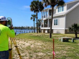
If the maps don’t match, or if the certificate is more than five years old, commission a new one. A licensed land surveyor with experience in coastal flood zones can complete this work relatively quickly.
The cost of a new elevation certificate is small compared to the cost of finding out after closing that the property’s flood insurance rates are about to jump or that your renovation plans require significant flood mitigation upgrades.
Frequently Asked Questions
How often should an elevation certificate be updated?
There’s no fixed rule, but any time FEMA updates the flood map for an area, existing certificates should be reviewed. If the map change affects the property’s flood zone or BFE, a new certificate is worth the cost.
Can an old elevation certificate be used for insurance purposes?
Yes, in many cases. But if it was completed before the current FIRM went into effect, the insurance rating may not be accurate. An updated certificate can sometimes lower premiums significantly.
Do all older waterfront homes need a new elevation certificate?
Not all of them. A certificate from five years ago may still be valid if no map changes have occurred. The key is comparing the certificate date to the effective date of the current FIRM for that property.
What does a new elevation certificate cost?
Costs vary by property and location, but a typical residential elevation certificate from a licensed surveyor generally runs between $500 and $1,000. For a waterfront property with complex conditions, it may be higher.
Who can complete an elevation certificate?
Only a licensed land surveyor, engineer or architect is authorized to complete FEMA’s elevation certificate form. The certificate must be signed and sealed to be valid for insurance or permitting purposes.
For a free land surveying quote, call us at (954) 250-5780 or send us a message by going here.
Posted in land surveying, land surveyor |