
How Drone LiDAR Mapping Improves Site Planning Before Construction Begins
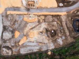 A construction site rarely looks the way it does on paper. Grass hides low spots. Brush hides slope changes. A quick walk-through can miss things that matter once equipment shows up.
That’s where drone LiDAR mapping comes in. It gives planners a full picture of a site before the first shovel hits the ground. For projects where storms can reshape a property overnight, that early picture matters even more.
See the Site Beyond What Ground-Level Inspections Reveal
A walking inspection tells you a lot. It just doesn’t tell you everything.
Grade changes can be subtle enough to miss on foot but big enough to affect drainage or foundation work. Vegetation can hide dips, mounds, or old fill areas. Photos flatten depth, so a slope that looks minor in a picture might be steeper than it seems on site.
Drone LiDAR mapping closes that gap. The drone flies a grid pattern over the property and fires laser pulses at the ground thousands of times per second. Each pulse bounces back and gets logged as a data point. Put enough of those points together and you get a detailed 3D model of the site, right down to small elevation shifts that a person on foot would never catch.
This matters most in the space between visual inspection and design decisions. An architect or engineer working off a walk-through and a few photos is working with gaps. A LiDAR dataset fills those gaps before the design phase locks anything in.
Account for Hurricane-Related Site Conditions Before Finalizing the Layout
South Florida construction has to plan around storms, not just around the site itself. Fort Lauderdale sits in a hurricane-prone zone, and that comes with its own set of planning headaches.
Heavy rain events can shift soil and expose drainage issues that weren’t visible before the storm. Coastal exposure adds salt air and wind loads to the list of things a design has to account for. And after a storm passes, a site can look completely different than it did during the last inspection. Debris, downed vegetation, and shifted grading are common, and they can throw off a visual assessment fast.
A LiDAR flight can capture current site conditions quickly, which helps when a design team needs an updated model after a storm event. It also picks up on drainage patterns that heavy rainfall tends to reveal, patterns that might not show up during a dry-season walk-through. For a site that’s already seen one hurricane season, that kind of data can prevent a design based on outdated assumptions.
Identify Design Constraints Before Equipment and Crews Arrive
Mobilizing a crew and then discovering a site problem is one of the most expensive mistakes in construction. LiDAR mapping helps catch those problems earlier.
A detailed point cloud shows existing grades, tree lines, structures, and access routes in one connected model. Planners can look at that model and flag conflicts before anyone shows up with equipment. Maybe a driveway grade is steeper than the plans assumed. Maybe a stand of trees sits closer to the build zone than expected. Maybe an access path that looked fine on satellite imagery turns out to be too narrow for delivery trucks.
Catching these things during planning costs a phone call and a design tweak. Catching them after mobilization costs schedule delays and change orders. The earlier a design team sees the real site, the fewer surprises show up once work begins.
Turn LiDAR Data Into a More Useful Pre-Construction Design Reference
One of the quieter benefits of LiDAR mapping is coordination. A single point cloud can become a shared reference for everyone involved in early planning, including architects, engineers, surveyors, and contractors.
Instead of each team working from separate site visits and separate assumptions, they’re all looking at the same 3D model. That cuts down on miscommunication and keeps design decisions grounded in the same data.
Fort Lauderdale requires current, signed and sealed surveys for exterior work. LiDAR mapping is excellent for planning, analysis, and early coordination, but it doesn’t replace a licensed survey where the project needs one. Think of it as a planning tool that runs alongside licensed survey work, not a substitute for it.
Decide When Drone LiDAR Mapping Is Worth Using Before Construction
LiDAR mapping isn’t necessary for every project. But certain site conditions make it worth the investment.
Complex sites with multiple grade changes benefit from the detail a point cloud provides. Heavily vegetated properties, where a walking inspection can’t see the ground clearly, are another strong candidate. Sites with difficult access, like steep lots or areas surrounded by water, are easier to plan around when the design team has an accurate model instead of guesswork.
Large or irregular parcels also make good candidates, since covering that much ground on foot takes time and still risks missing details. And for any project where a late-discovered site issue would force a costly redesign, mapping the site early is cheap insurance against that outcome.
If a project checks any of these boxes, especially in a hurricane-prone market like Fort Lauderdale, drone LiDAR mapping is worth bringing into the planning phase from the start.
Frequently Asked Questions
What is drone LiDAR mapping used for in construction planning?
It’s used to capture a detailed, accurate model of a site before design work locks in. Planners use that model to check grades, spot obstacles, and confirm site conditions before crews arrive.
How is LiDAR mapping different from a traditional survey?
LiDAR mapping creates a broad 3D dataset of the site’s surface and features. A licensed survey provides legally certified boundary and elevation data. They serve different purposes, and in Fort Lauderdale, exterior work still requires a signed and sealed survey.
Can drone LiDAR mapping help after a hurricane?
Yes. A LiDAR flight can capture updated site conditions quickly after a storm, which helps design teams see how rain, wind, or debris changed the property before finalizing plans.
Does LiDAR mapping work on heavily wooded properties?
It works especially well there. The laser pulses can pass through gaps in tree canopy and pick up ground-level detail that a photo or walking inspection would miss.
How soon before construction should a site be mapped with LiDAR?
Early enough that the design team can react to what the data shows. Mapping during the planning phase, before layouts are finalized, gives architects and engineers time to adjust for anything the model reveals.
For a free land surveying quote, call us at (954) 250-5780 or send us a message by going here.
Posted in LiDar mapping | Tagged lidar mapping