
Land Survey Company Before Adding a Commercial Drive-Thru
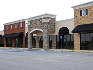 A drive-thru lane looks simple on a napkin sketch. On a real site, it has to wrap around a building, hold a line of cars, stay clear of the parking lot, and drain properly, all without crossing a property line or easement. Most drive-thru additions go onto sites that are already built out, which leaves very little room for error. Hiring a land survey company before design starts shows exactly how much space you have to work with.
This guide is for commercial property owners, franchise operators, and developers adding a drive-thru to a restaurant, bank, pharmacy, or retail building. Engineers and contractors on those projects can use it as a checklist. The main point is straightforward. Measure the site first, then design the lane around what’s actually there.
Survey Existing Conditions Before Drive-Thru Design Begins
An existing conditions survey maps everything on the site today. That includes the building footprint, doors, parking stalls, curbs, islands, landscaping, light poles, signs, dumpster enclosures, and utility features. For a drive-thru, the building walls matter a lot, since the pickup window and menu board have to fit along them. Accurate measurements keep the architect from designing around a sidewalk or column that isn’t where the old plans show.
Existing sites almost never match their original drawings. Parking gets restriped, islands get added, and utility boxes appear over the years. A land survey company records current conditions so nothing slips through. Ask the surveyor to pick up overhangs, canopies, and door swings along the side where the lane will run.
Verify Property Boundaries, Setbacks, and Easements
A drive-thru lane often ends up near the edge of the property, so the boundary needs to be exact. A boundary survey locates the lot lines and corner monuments and shows where the property actually ends. Setbacks, which are the minimum distances structures must keep from lot lines, may apply to canopies, menu boards, or pavement depending on local rules. Those rules vary by municipality, county, and zoning district.
Easements can sink a drive-thru plan quickly. Utility, drainage, and access easements may run right where the lane needs to go. Shopping center sites often have recorded agreements that control parking, access, and shared drives among several owners. The surveyor can plot recorded easements from your title work, and your attorney can explain what the agreement language allows.
Map Driveway Access and Vehicle Circulation Areas
Circulation is where drive-thru projects succeed or struggle. The survey should show every driveway, curb cut, drive aisle, parking row, and pedestrian path on the site. Your engineer uses that data to lay out the queue lane, which is the lane where cars line up to order and pick up. The lane needs enough length and turning room that waiting cars don’t block parking or spill into the street. Circulation items the survey should capture include the following.
- Driveway widths and curb cut locations
- Drive aisles, parking stalls, and islands
- Pedestrian crosswalks and accessible routes
- Loading areas and dumpster access
- Traffic signs, striping, and light poles
Many jurisdictions set minimum stacking space, meaning how many cars the queue must hold, and the numbers vary by location and use. Some sites also need a bypass or escape lane so drivers can leave the line. The survey lets the designer test those layouts against real curb lines and turning room. Ask your engineer to check truck routes too, since delivery and trash trucks still have to reach the building.
Measure Site Grades for Drainage and Pavement Planning
A drive-thru adds or reshapes pavement, and pavement changes how water moves. Topographic data, which maps ground elevations and slopes, shows where water flows today and where it will go after construction. Engineers use it to set lane grades, curb heights, and inlet locations. Without it, water can pool right at the pickup window.
Existing parking lots are often flatter than they look. A small grade error can leave standing water in the queue lane or send runoff toward the building. Ask for enough spot elevations along the planned lane, the building wall, and existing inlets. Stormwater requirements vary by jurisdiction, so confirm whether new pavement triggers added treatment or storage.
Grades matter for people on foot as well. Accessible routes from parking to the entrance often cross or run beside a drive-thru lane, and they have strict slope limits under accessibility standards. Measured grades help the designer keep those routes compliant.
Coordinate Survey Data With Drive-Thru Construction Plans
The survey becomes the base for the civil site plan, the architectural plans, and the permit set. Everyone on the design team should work from the same file and coordinate system. When the lane, window, or canopy shifts, the surveyor can check the new layout against boundaries, easements, and setbacks before it goes to permit. That small step heads off review comments that stall approval.
During construction, the land survey company can stake lane edges, curb lines, and building additions on the ground. Staking marks where contractors should build, so the finished work matches the approved plan. A final or as-built survey may be required afterward, depending on the jurisdiction and your lender. Build survey time into the schedule early if an opening date or loan draw depends on it.
This is general information, not legal advice. Drive-thru rules, driveway permits, and stormwater requirements depend on your location, zoning, and project scope. Talk with your engineer, the permit office, and your attorney as needed. A clear survey gives all of them the same accurate starting point.
Frequently Asked Questions
Do I need a survey to add a drive-thru?
Most drive-thru additions need current survey data for design and permitting. Requirements vary by municipality, county, and project scope. Even when a survey isn’t strictly required, designing without one risks conflicts with lines, easements, or grades. Ask your engineer and permit office what they expect before design starts.
What type of survey does a drive-thru project need?
Most projects use a boundary survey combined with a topographic or existing conditions survey. Some also need utility locating, and a commercial purchase or refinance may call for an ALTA/NSPS survey. Your engineer will usually define the exact scope. A land survey company can often bundle these into one deliverable.
How much space does a drive-thru need?
Space needs depend on stacking requirements, lane width, turning room, and the building layout. Stacking and lane rules vary by jurisdiction and business type. A survey shows the real space available so your engineer can test different layouts. Check local code before committing to a design.
Can a drive-thru lane cross an easement?
Sometimes, depending on the easement type and its recorded language. A utility easement may allow pavement but not structures, while other easements may restrict certain uses. Shopping center agreements can add their own limits on top of that. Have your attorney review the recorded documents before finalizing the layout.
How long does a commercial site survey take?
Timing depends on site size, records research, utility work, and the surveyor’s workload. A small commercial pad may take a couple of weeks, while larger or more complex sites take longer. Traffic and business hours can also affect fieldwork on an open site. Order early if permits or a lease deadline depend on the results.
For a free land surveying quote, call us at (954) 250-5780 or send us a message by going here.
Posted in boundary surveying | Tagged boundary surveying