
Land Surveying Before Combining Adjoining Commercial Lots
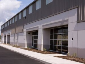 You own two lots side by side. Now you want to build one bigger project across both. To do that, the two parcels often need to become one. Land surveying is the first real step in that process.
Combining lots sounds simple on paper. In practice, each parcel has its own lines, records, and rights. Those pieces have to line up before the merge can work. A survey brings the two into one clear picture.
Here is what to know up front. A survey confirms the true edges of both lots and what sits between them. It flags easements, gaps, and structures that could block the plan. Get it done early, and the rest of the project moves with fewer snags.
Why Surveying Matters Before Combining Commercial Lots
Combining lots means merging two parcels into one legal property. This is often called lot consolidation. Before that can happen, the commercial property boundaries of both parcels need to be clearly established. This helps confirm that the lots meet as expected and provides accurate information for the consolidation process.
The survey sets the base for the whole merge. It shows both parcels drawn to scale on one map. It confirms where each lot starts and ends. That clarity keeps the project on solid ground.
Skipping this step invites costly errors. A hidden gap between the lots can stall the plan. An easement down the old line can limit the build. A survey finds these issues while they are still cheap to fix.
Verifying Boundaries and Legal Descriptions Between Adjoining Parcels
Every lot has a legal description in the records. It is the written definition of the property’s edges. The surveyor reads both descriptions with care. They check that the two lots truly meet along one line.
Sometimes the records do not match the ground. There may be a gap or an overlap between the parcels. A shared line may not sit where either owner thought. The surveyor measures the land to sort out the truth.
Once the lines are clear, a new description can be written. This single description covers the combined lot. It replaces the two old ones after approval. A clean description keeps the title and future deals simple.
Reviewing Easements, Access, Utilities, and Existing Improvements
The old shared line often carries rights and services. An easement is a right for others to use part of the land. A utility line may run right along the border. These do not vanish just because the lots merge.
The surveyor maps each easement, pipe, and wire. Some easements may need to stay for the utility owner. Others may need to be vacated to clear the build area. Knowing this early shapes your design and your paperwork.
Existing structures need a close look too. A wall, a drive, or a sign may cross the old line. Once the lots combine, that crossing may no longer be a problem. But you still need the survey to confirm where everything sits.
When ALTA or Topographic Surveys Support Lot Consolidation
Some merges call for a deeper survey. An ALTA survey is a detailed report used for commercial deals. It ties boundaries, easements, and title items into one document. Lenders and title companies often want it before they fund a project.
For a consolidation, the ALTA survey shows the full picture. It reveals rights that records alone can miss. It helps confirm clear title across both lots. That matters when a loan or a sale depends on the merged parcel.
A topographic survey adds the shape of the land. It maps slopes, low spots, and drainage paths. This data guides grading and stormwater plans for the new site. Together, these surveys give your design team what they need.
Using Survey Results for Site Planning and Development
The survey becomes a working tool once the lots combine. Your architect and engineer build the site plan on it. They place the new building, parking, and access with real data. This lowers the risk of a costly redesign.
The survey also guides permits and approvals. City staff check setbacks and coverage against the map. A clear survey answers their questions fast. That can speed up your review and your timeline.
Requirements can vary by property type, municipality, and project scope. Confirm your survey and permit needs early, before you finalize the design. A strong survey turns two separate lots into one buildable site. It sets the whole project up to succeed.
For a free land surveying quote, call us at (954) 250-5780 or send us a message by going here.
Posted in land surveying | Tagged land surveying