
Survey Drones Are Changing How Large Sites Get Planned
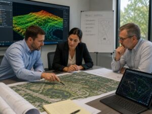
A 40-acre site used to take survey crew days to walk and measure. Now survey drones can cover the same ground in hours.
That shift matters most for developers working on large parcels. Bigger sites mean more terrain to capture, more vegetation to work around, and more decisions that depend on accurate data before design even starts. Survey drones changed how fast that data comes back, and how much of the site gets captured in the first pass.
Most of that speed comes from LiDAR mapping, the technology that does the actual work behind a modern survey drone. The drone is just the vehicle. LiDAR is what pulses laser light across the site and turns it into a detailed, measurable picture of the ground below.
The Acreage Problem Drones Were Built to Solve
Large sites create a basic math problem for traditional ground surveying. More acres means more time. More time means a higher cost before a single design decision gets made.
A 5-acre infill lot is manageable on foot. A 40-acre or 100-acre site is a different job entirely. Dense vegetation, water features, and uneven terrain can slow a ground crew down for days, especially across a property that large.
Survey drones change that math directly:
- One flight can cover dozens of acres in a single session
- Hard-to-reach areas, like wetlands or dense brush, become accessible from above
- Coverage that used to take a full week can often wrap in a day or two
For a developer evaluating a large parcel, that speed means real data arrives early enough to actually shape the design, instead of confirming decisions that were already made on assumptions.
What Gets Captured That a Walking Survey Often Misses
A ground crew measures specific points with precision. A drone equipped with LiDAR captures the entire surface in between those points, and that gap turns out to matter more than people expect on large sites.
LiDAR works by sending out thousands of laser pulses per second and measuring how long each one takes to bounce back. That builds a dense, accurate map of elevation and surface detail across the whole property, not just at sampled points a crew happened to walk.
What a full-site LiDAR capture typically shows:
- Elevation changes across the whole property, not just at sampled points
- Drainage patterns that only become visible when the full site is mapped together
- Vegetation density and tree canopy spread across the parcel
- Existing access routes and how they connect across a large or irregular site
On a small lot, missing one of these details rarely changes much. On a 60-acre site, a drainage pattern hiding in a section nobody walked through can quietly shape an entire grading plan once it gets discovered later, usually at a worse time than during initial planning.
Why Site Size Changes the Planning Conversation Itself
Small projects can often move from concept to permit with a handful of site visits. Large sites can’t work that way, and survey drones changed what that planning conversation actually looks like.
With a full aerial dataset available early, teams can:
- Compare multiple building or layout options against real terrain data, not estimates
- Identify the most buildable sections of a large site before committing design time to the wrong area
- Spot natural constraints, like low-lying zones or dense tree cover, before they shape a budget surprise later
- Share one consistent aerial reference across architects, engineers, and contractors working the same large property
That shared reference matters more as site size grows. A 5-acre lot might only involve a handful of people checking the same plan. A large multi-phase development can involve dozens of people across different firms, and a single accurate dataset keeps everyone working from the same picture of the land.
Where Ground Crews Still Matter on a Large Site
Drones changed how fast a large site gets mapped. They didn’t replace the need for boots on the ground, especially where legal accuracy is required.
Ground survey work still handles:
- Establishing precise legal boundary corners, which require certified field methods
- Verifying monuments that LiDAR can’t always pinpoint with the precision a legal filing requires
- Confirming details in areas where laser pulses get scattered or blocked by dense shadow
- Producing data that meets the certification standards required for permitting and legal filings
One advantage worth noting: LiDAR pulses can pass through small gaps in tree canopy that a regular camera lens can’t see through, often picking up ground detail a standard photo-based drone survey would miss entirely. Even with that advantage, dense canopy still limits what gets through, which is why ground verification remains necessary on heavily wooded parcels.
The most reliable large-site surveys in Fort Lauderdale combine both. Drone data covers the property fast and broadly. Ground crews confirm the legal and technical details that still require certified field work. Skipping the ground component on a large parcel, especially anything involving legal boundaries, creates risk that speed alone can’t fix.
What This Means for Planning a Large Development
For a developer looking at a large site, the practical takeaway is timing. Survey drones make it realistic to get a full picture of a large property early, before significant design money gets spent.
Steps that take advantage of this shift:
- Request an aerial dataset before finalizing site layout, not after a design is already drawn
- Use the data to identify the most buildable zones early, especially on irregular or large parcels
- Pair drone data with ground verification for anything involving legal boundaries or permitting
- Share the same dataset across the full project team, so everyone works from one accurate view of the site
On a large parcel, the cost of getting this wrong only grows with acreage. A small misread on a half-acre lot is a minor fix. The same misread across 50 acres can mean redesigning an entire section of a development.
Frequently Asked Questions
How much faster is drone mapping than a traditional ground survey on a large site?
The time savings depend on the size and terrain of the property. A drone can often map dozens of acres in just a few hours, while a traditional ground survey of the same area may take several days.
Can a drone survey replace a legal boundary survey on a large property?
No. Drone surveys provide valuable aerial data for planning and design, but legal property boundaries must still be established using certified ground-based surveying methods.
Do survey drones work well on heavily wooded sites?
Dense tree cover can limit a drone’s ability to capture the ground surface accurately. In wooded areas, surveyors often combine drone mapping with ground surveys to ensure complete and reliable data.
Is drone mapping more expensive than a traditional survey for large properties?
Not usually. For larger sites, drone mapping is often more cost-effective because it can collect detailed information over a much larger area in less time than a ground crew alone.
What size property benefits most from survey drones?
Properties larger than 10 to 20 acres typically see the greatest advantages in speed and efficiency. However, smaller sites with difficult terrain or limited access can also benefit from drone surveying.