
Why New Flood Maps Can Make an Elevation Certificate Worth Revisiting
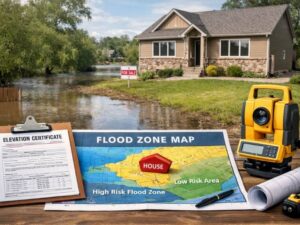
An elevation certificate doesn’t expire on a calendar. The flood map underneath it can still pull the rug out.
That’s the part developers often miss. Broward County rolled out new Flood Insurance Rate Maps in 2024, and around 88,000 properties got added to flood zones that weren’t there before. If your project’s elevation certificate was based on the old map, the numbers on that document may no longer match the flood zone your property actually sits in today.
An elevation certificate is only as current as the flood map it references. When the map changes, the certificate needs a second look, even if nothing on the building itself changed.
What an Elevation Certificate Actually Locks In
An elevation certificate records a building’s elevation compared to the base flood elevation for its zone. A licensed surveyor measures the lowest floor, ties it to the flood zone designation in effect, and produces a document lenders and insurers rely on.
That document doesn’t carry an expiration date printed on it the way a license does. But it’s built on a snapshot. The flood zone, the base flood elevation, and the map panel number are all pulled from FEMA maps that were active on the day the survey happened.
Why the Map Date Matters More Than the Certificate Date
If FEMA remaps your area and the base flood elevation goes up, or your property moves from a moderate-risk zone into a high-risk one, the old certificate is still technically valid as a document. It’s just describing a flood risk that no longer reflects current mapping.
For insurance pricing and permitting purposes, that gap matters. A certificate showing compliance under an old map doesn’t automatically prove compliance under a new one.
What Changed in Broward County
FEMA’s updated Flood Insurance Rate Maps for Broward County took effect on July 31, 2024. The update reclassified a large number of parcels, pulling tens of thousands of properties into Special Flood Hazard Areas for the first time.
Fort Lauderdale sits inside that update. Projects permitted or insured under the prior maps may now fall under different zone designations, different base flood elevations, or both.
Three Triggers That Should Send You Back to the Surveyor
- A new FEMA map takes effect for your jurisdiction. Even without construction changes, the zone or base flood elevation tied to your property can shift.
- You’re refinancing or selling. Lenders check current flood zone status, not the zone status from your original certificate date.
- You’re applying for a building permit or addition. Permitting offices reference the active map, not the one your existing certificate was built on.
How This Plays Out for a Development Project
Picture a multi-unit project that pulled its elevation certificate in 2022, under the maps active at the time. Construction wraps in 2025, after Broward’s updated FIRMs are already in effect.
If the property’s zone changed under the new map, the original certificate no longer reflects the flood risk a lender, insurer, or building official will check against. The fix isn’t always a full new survey. Sometimes it’s a re-certification confirming the building’s elevation still clears the new base flood elevation. Either way, the gap needs to be closed before closing, before issuing a certificate of occupancy, or before binding insurance.
What to Do When a Flood Map Updates
- Pull the current flood zone for the property, not the zone listed on your existing paperwork.
- Compare the old base flood elevation to the new one. A higher number means your building’s clearance margin may have shrunk.
- Ask your surveyor whether a full re-survey is needed or just a recertification. The scope depends on how much the data changed.
- Loop in your insurance agent early. Updated zone data can change premium calculations before the policy renews.
- Keep both certificates on file. Lenders and title companies sometimes want to see the history, not just the current version.
Frequently Asked Questions
Does an elevation certificate expire?
No. There’s no built-in expiration date. It becomes outdated when the flood map it references gets replaced, not because of time passing on its own.
How do I know if my property’s flood zone changed?
Check the current Flood Insurance Rate Map for your address through FEMA’s Map Service Center or your local floodplain management office. Compare it against the zone listed on your existing elevation certificate.
Do I need a brand new survey every time FEMA updates a map?
Not always. If your building’s elevation still clears the new base flood elevation, a re-certification may be enough. A full re-survey is typically needed if the structure or grading changed since the original certificate.
Will a flood zone change affect my flood insurance premium?
It can. Moving into a higher-risk zone or seeing the base flood elevation increase often raises premiums, while moving into a lower-risk zone can lower them. An updated certificate gives your insurer accurate numbers either way.
Who do I contact to check if Fort Lauderdale’s flood maps have changed?
The City of Fort Lauderdale’s Building Services division and Broward County’s flood zone map resources both publish current FIRM information and can confirm whether a property’s designation has shifted.
For a free land surveying quote, call us at (954) 250-5780 or send us a message by going here.