When an Old Land Survey Isn’t Enough And What to Do Next
 You find your land survey in a folder. It looks clean and official, so you assume it still works. Many property owners think the same way. The document feels permanent, yet the land itself keeps changing.
A land survey shows what existed at one moment. Time moves forward, and your property moves with it. Small updates add up, and before long, that old survey no longer matches what’s outside your door.
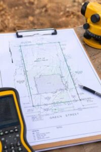
A Survey Reflects a Specific Moment
A land survey shows your property as it looked on the day it was done. After that, the document stays the same, even though the property does not.
At first, you may not notice much has changed. Over time, though, small updates start to add up. You might add something, the ground might shift a bit, and nearby properties can change too. Everything can still look fine at a glance, but the details may no longer match what’s on your survey.
That’s usually the point where it helps to take a step back and review your current land survey, just to see if it still lines up with what’s actually there. Even small gaps between paper and reality can lead to bigger problems later on.
Changes That Slowly Make a Survey Outdated
Most properties don’t stay frozen in time. You add something here, adjust something there, and the layout starts to drift from what was originally recorded.
A new patio or shed seems harmless at first. Then a driveway gets widened, or the yard gets reshaped. These changes feel small, yet they affect how space is used. Your old survey won’t show any of it.
Natural changes also play a role. Heavy rain can shift soil. Water may start flowing in a different direction. In Fort Lauderdale, this happens more often than people expect. Over time, the land itself may not behave the same way it once did.
Nearby activity adds another layer. A neighbor builds close to the line, or a new structure appears next door. Suddenly, what you see on the ground doesn’t match what’s on your survey. That can create confusion, even if no one intended to cause an issue.
Why Old Information Leads to Real Problems
At first, everything seemed fine. Then you start planning a project, and things feel off.
You measure based on the old survey, but the space doesn’t match. Something sits closer than expected. Plans need to shift, and now you’re adjusting on the fly.
This often leads to delays. Work pauses while details get checked. Costs increase because changes happen mid-project. What looked simple at the start becomes frustrating.
These issues don’t come from bad decisions. They come from using information that no longer fits the current property.
When a New Survey Becomes the Smarter Choice
There comes a point when relying on an old survey creates more risk than value. That point usually shows up when you plan changes.
You may want to add something, adjust the layout, or improve the property. At that stage, accuracy matters. Guessing based on outdated information can lead to mistakes.
Even if your plans seem small, the details still count. A few feet off can change how everything fits together. Getting an updated survey helps you move forward with clarity instead of doubt.
What a New Land Survey Brings to the Table
 A new survey reflects what exists right now. It shows current structures, updated layout, and accurate boundaries.
That clarity makes planning smoother. Contractors can rely on real measurements. Designers can work with confidence. Everyone works from the same understanding of the property.
This also reduces back-and-forth. You avoid second-guessing, and projects move forward without unnecessary pauses.
Why This Matters More in Fort Lauderdale
Fort Lauderdale properties face constant change. Weather plays a big part. Frequent rain can affect ground conditions over time, and water movement may shift across a property in ways that aren’t obvious at first.
At the same time, nearby development continues to grow. New construction, updated homes, and changing surroundings all influence how your property fits within its space.
Because of this, older surveys lose accuracy faster. What worked years ago may no longer reflect today’s conditions.
A Better Way to Look at Your Survey
An old survey isn’t useless. It still tells part of the story. However, it doesn’t show what has changed since it was created.
That’s the key point.
If your property has evolved, your survey should keep up. Otherwise, you’re planning based on outdated information.
For a free land surveying quote, call us at (954) 250-5780 or send us a message by going here.
Posted in land surveying, land surveyor |